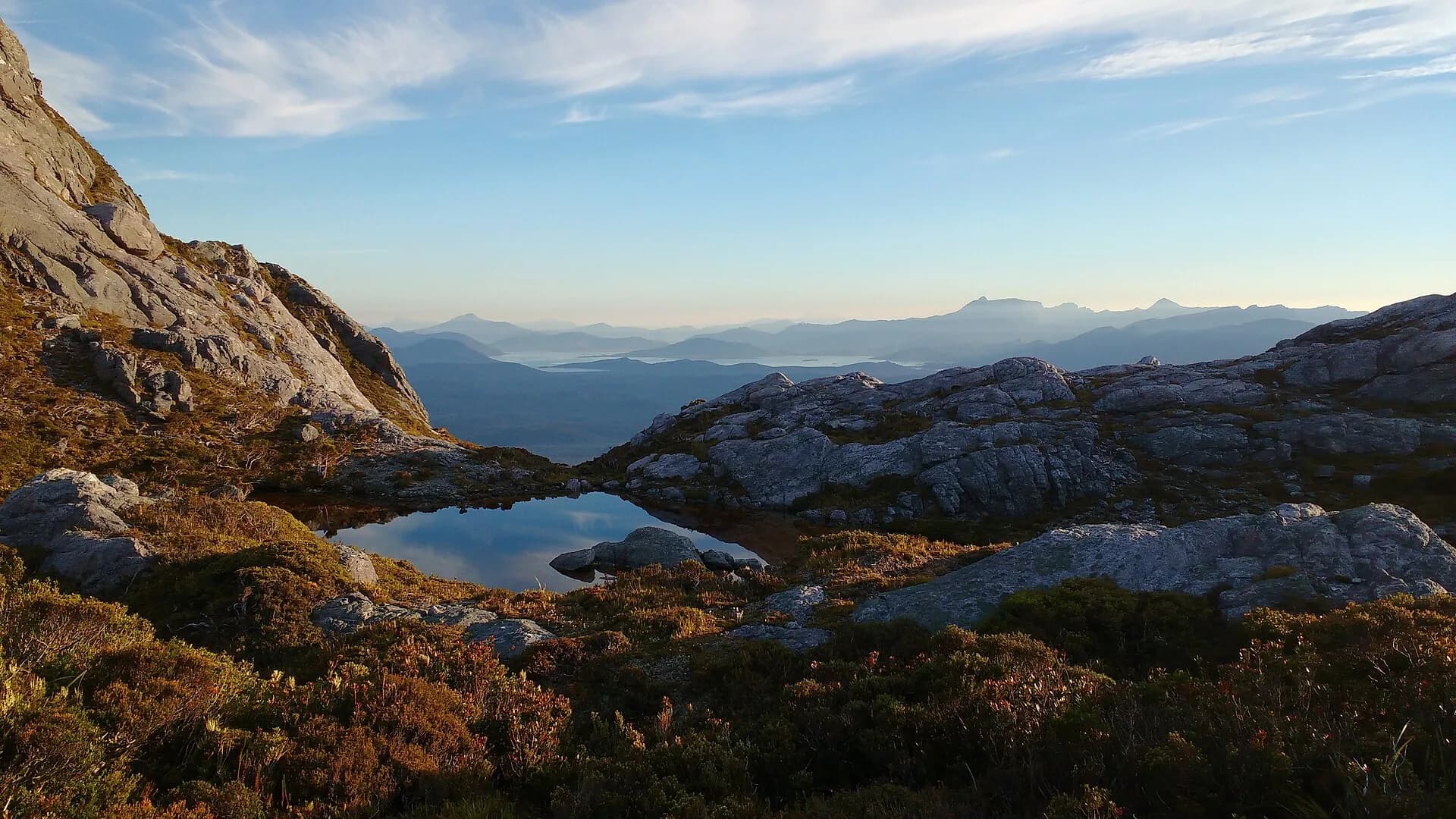

Why this route demands respect
The Western Arthur Range is a high, serrated ridge above the buttongrass plains of the Southwest National Park. Parks and Wildlife Service grades the traverse as Grade 5 and describes it as suitable only for very experienced walkers. Short distances can become slow, technical days when weather or rock conditions worsen.
The route includes exposed crest walking, steep gullies, extensive boulder-hopping and sections that commonly require rock scrambling and pack-hauling. Cairns are intermittent on the ridge. Parties should expect slow progress and significant objective hazards on some sections.
Daily segments and realistic timing
The full loop is commonly planned as a multi-day trip of about 58 kilometres, often completed in five to seven days by experienced parties. The walk notes break the route into daily sections that reflect the terrain rather than distance alone. Typical segments include the approach to Junction Creek, the steep climb to Alpha Moraine and the exposed crest, short ridge sections between lakes such as Cygnus and Oberon, then the much rougher country beyond Lake Oberon to Haven Lake and down to the plains.
Allow plenty of time in your daily plan. Sections that appear short on a map can take many hours because of route-finding, scrambling and pack-hauling. If you are newer to this terrain, add extra days rather than trying to accelerate the schedule.
Terrain, hazards and water
After Lake Oberon the route becomes notably rougher and more exposed. Expect serrated ridges, high cliffs, steep gullies, unstable boulder fields and places that will require you to haul packs or move slowly for safety. Heavy rain can make creek crossings impassable and can flood low-lying campsites. Some lakes and tarns are intermittent sources of water, and water scarcity is a realistic risk on parts of the ridge during summer and early autumn. Carry sufficient water and a plan to reach reliable water at Haven Lake.
Campsites near Junction Creek and other low-lying areas can flood in heavy rain. Several exposed high-country sites offer little shelter from wind and driving rain, so be prepared for extended periods of wet, cold weather.
Mandatory registration, fire rules and shelter requirements
All walkers on the traverse must register with Parks and Wildlife Service, including those only intending to complete part of the route. Registration supports park management and search planning.
This part of Tasmania sits in the Tasmanian Wilderness World Heritage Area and Southwest National Park, which are Fuel Stove Only areas. Campfires are prohibited; you must carry and use an approved fuel stove for cooking and boiling water. Parks guidance requires multi-day walkers to carry a quality tent rated for three to four seasons with inner and outer layers; huts and guaranteed shelter are not available on demand. A PLB is strongly recommended for remote emergency signalling and many parties choose to hire one if they do not own one.
Navigation, skills and emergency planning
Good navigation and remote-first-aid skills are essential. The ridge is marked only by intermittent cairns in places and route-finding through gullies and buttresses is necessary. Carry printed topographic maps and be able to use them; mobile phone coverage is not reliable in this terrain.
Decide turnaround thresholds before committing to exposed climbs such as Alpha Moraine or the crest beyond Lake Oberon. Parks advice is explicit: sections past Lake Oberon are substantially harder and should only be attempted in fair weather by experienced parties. Be prepared to stop, shelter or retreat if weather, party fitness or daylight margins deteriorate.
Carry spare food for delays, a storm-worthy shelter and a fuel stove. Pack a sleeping system rated for cold alpine conditions and a sleeping mat. Follow the official multi-day pack list for remote alpine walks rather than relying on a day-walk kit.
Access, conditions and pre-departure checks
Before you go, check current park alerts and weather forecasts. Parks and Wildlife Service maintains alerts for parks and reserves and advises walkers to check those pages as part of trip planning. Also consult the Bureau of Meteorology for alpine forecasts and the Tasmania Fire Service and PWS planned burns pages for fire information.
Check route status at visitor centres or with park staff if you can. Ask about campsite flooding history, creek crossing conditions and any temporary closures or works that may affect access. If you plan to hire a PLB, note that hire points exist at some Service Tasmania outlets and park visitor centres but numbers may be limited.
Leave clear trip intentions with a reliable contact, record your party details in the log books where provided and carry a map and PLB. Because weather and ground conditions change rapidly in this region, plan for flexibility and accept that turning back is a likely and sensible option.
Suitability and final checks
This traverse is for very experienced walkers with alpine navigation, scrambling and emergency management skills. If you or members of your party lack regular experience on rough, exposed, unmarked high-country routes, consider building skills on easier Grade 4 terrain first.
Before departure check: that you have completed registration, that tents and sleeping kits meet the 3-4 season guidance, that you have a fuel stove and enough fuel, that someone reliable has your itinerary, and that you can hire or carry a PLB. Confirm water plans for sections where water may be scarce and agree turnaround triggers for key objectives on the crest.
Respect the route by planning conservatively. The Western Arthurs can be remote and unforgiving, and good preparation is the most effective way to manage the hazards it presents.