
Intro
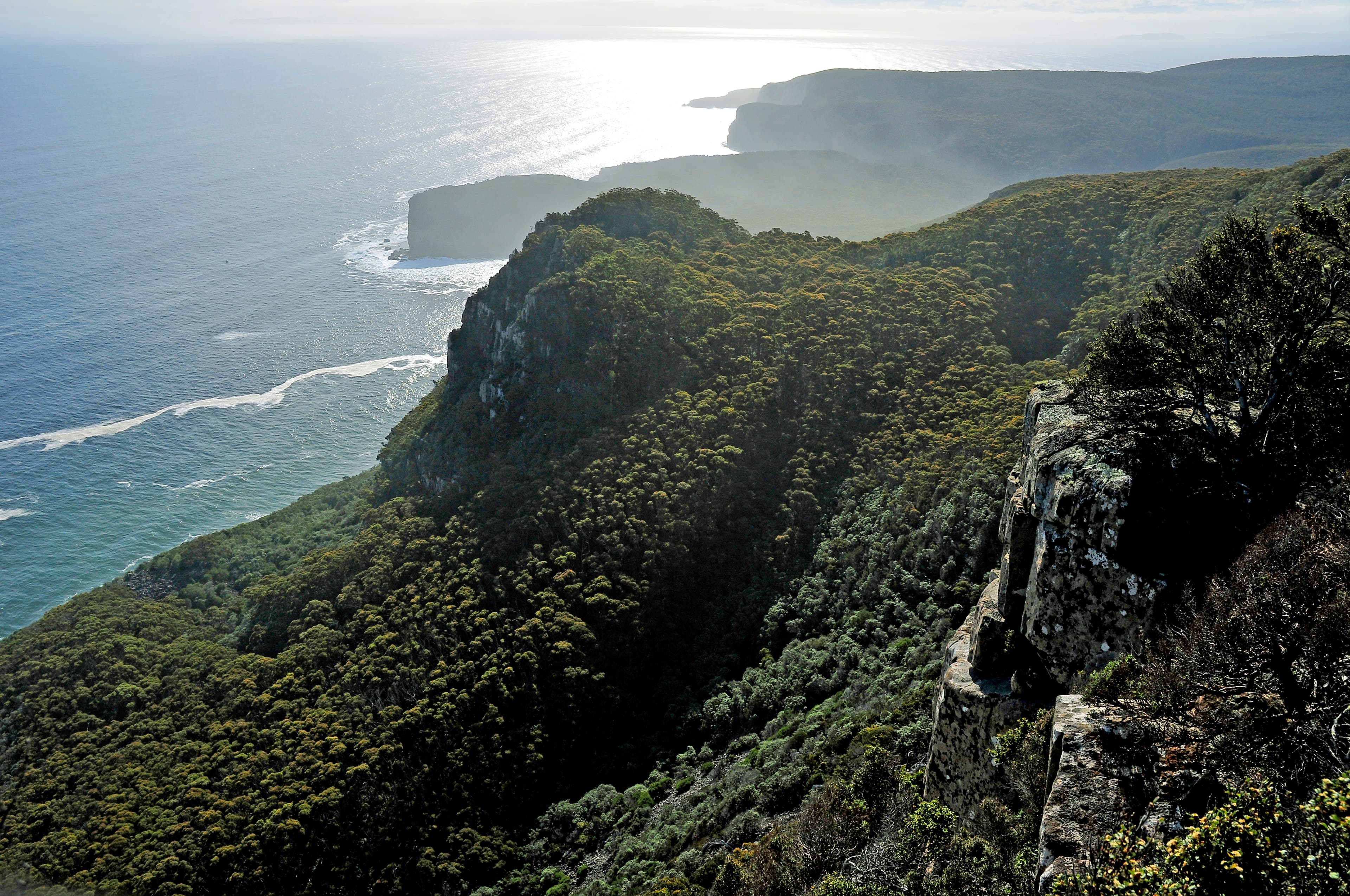
Shipstern Bluff sits inside Tasman National Park on the Tasman Peninsula. The site is widely known for very large, complex surf breaking on a shallow, irregular reef. The location is best treated as a full-day coastal bushwalk rather than a quick roadside stop. This guide summarises access, track options, terrain, hazards and the checks to complete before you go.
Getting there and access
Tasman National Park is reachable from Hobart on sealed roads in around a 90-minute drive via Sorell. The common vehicle access for the Shipstern Bluff walk starts at the end of Stormlea Road, off Nubeena Road. The park is managed by Parks and Wildlife Service Tasmania. A valid parks pass is required for entry to Tasmania's national parks and should be organised before you park or enter a managed area.
Trailheads and typical timings
Two route options are commonly described in park materials. The full Shipstern Bluff and Tunnel Bay return is listed at about 4.5 hours. A shorter return to a lookout over Shipstern Bluff and the headland near Cape Raoul is listed at roughly two hours. These times are guides only. Expect slower progress where the track is muddy, windblown or where fitness and on-the-day conditions affect pace. Plan to complete the return well before dark.
Terrain, track quality and what to carry
The walk crosses coastal heath, patches of eucalypt forest and exposed cliff-top sections. The track is a bush route, not a sealed promenade, and offers varied footing including narrow sections and uneven ground. Carry sufficient water and food for the day, reliable navigation (map and compass or a GPS device), sun protection and rainproof clothing. Mobile phone reception can be unreliable in parts of the peninsulas; make important planning checks before you leave the road. A basic first aid kit and a headlamp are recommended if there is any risk of returning after dusk.
Cliffs, surf and spectator safety
Shipstern Bluff is a big-wave site where dangerously large waves can form on a shallow, irregular reef. These waves are appropriate only for expert big-wave surfers operating with specialist support. For walkers and spectators the principal hazards are unfenced cliff lines and powerful seas. Stay on the formed track, keep well back from cliff edges and avoid scrambling onto rock platforms. Wet or wind-scoured cliff edges worsen the risk. If weather or swell increases unexpectedly, choose the lower risk option and return rather than extending the walk.
Tunnel Bay, sea caves and route notes
The longer route reaches coastal features such as sea caves and Tunnel Bay. Expect narrow coastal track and unfenced cliff lines for much of this terrain. These areas are remote and exposed. If your return would extend into low light, reconsider pushing on to Tunnel Bay on the same day. Combining Shipstern Bluff with multiple major Tasman Peninsula attractions in one day often leaves little time to move safely between sites and to return before dark.
Park facilities, contacts and suitability
Tasman National Park contains a range of features from towering dolerite sea cliffs to sandstone formations. Park visitor services include a Tasman Field Centre and managed campgrounds in the wider park. The Parks and Wildlife field office lists opening hours for public enquiries and services; check the current office hours and campsite booking arrangements before you travel. The walk is best suited to experienced bushwalkers comfortable with coastal exposure and remote tracks. It is not a casual roadside viewpoint.
Checks and last-minute precautions
Before you set out, check the latest park alerts and the weather forecast. Park management publishes track and safety notices; verify any closures or temporary restrictions that affect the Tasman Peninsula. Confirm mobile reception expectations at your starting point and leave a clear plan with someone if you will be walking alone. Allow extra time compared with published track durations and be prepared to cancel or shorten the walk if conditions make cliff-top routes dangerous.
Practical day-of tips
Start early to allow plenty of daylight for the return. Wear sturdy footwear and layered clothing suitable for strong coastal winds and sudden showers. Fill water containers before leaving the road and carry more than you expect to need. Keep all valuables and electronic equipment secure from spray and sand. Observe wildlife from a distance and respect cultural sites and signage. Treat the Shipstern Bluff outing as a remote coastal bushwalk: plan for exposure, changing weather and limited services once you leave the car.