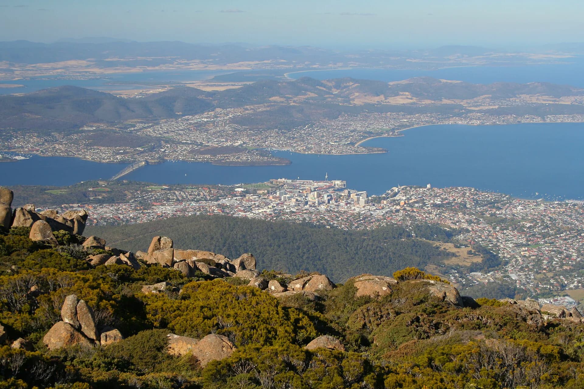

The river that shapes Hobart is both a long freshwater system and a broad tidal estuary. It rises at Lake St Clair, runs through the Derwent Valley and becomes salt water well before it reaches the city. The official Tasmanian Government history page for the new Bridgewater Bridge describes the river system as more than 190 kilometres long, followed by an estuary of about 60 kilometres to the Iron Pot.
Its names belong to different histories. timtumili minanya is the palawa kani name used for the river. River Derwent is the introduced name that became fixed on British charts after John Hayes entered the estuary in 1793. Along both shores, names record Aboriginal Country, French and British voyages, colonial officials, landholders, industries and local habits. Reading a map of the Derwent is therefore a way of reading several histories at once.
Before the charts
The lower river crosses the Country of several Tasmanian Aboriginal groups. Around present-day nipaluna / Hobart, the western shore was Muwinina Country. The area around kutalayna / Jordan River and the eastern shore was associated with the Mumirimina people. The river was a travel route, food source and meeting landscape long before European surveyors drew coastlines around it.
Tasmania's Aboriginal and Dual Naming Policy recognises that geographic features had Aboriginal names for thousands of years before colonisation. It also makes clear that official naming is a formal process led by the Place Names Advisory Panel with advice from Aboriginal language experts. Historical spellings recorded by Europeans are not automatically reliable Aboriginal names. This page uses names recognised by current authoritative sources and avoids inventing equivalences where the evidence is uncertain.


How “Derwent” arrived
The French expedition led by Bruni d'Entrecasteaux surveyed the estuary early in 1793 and called it Rivière du Nord. A few months later, Lieutenant John Hayes of the Bombay Marine entered the same water without knowing of the French survey. He applied the name Derwent, recalling the river of that name in Cumberland, England, near his birthplace.
Hayes's chart helped the British name endure. Matthew Flinders and George Bass sailed the Norfolk into the river in 1798. British settlements followed at Risdon Cove in 1803 and Sullivans Cove in 1804. “Derwent” then became part of an administrative and commercial geography that appeared in shipping records, land grants and official maps.
The sequence matters. Europeans did not discover an unnamed place. They overlaid new names on a living Aboriginal landscape, sometimes without recording the names already in use.
Reading the western shore
Moving north from Storm Bay, familiar names cluster around the water. The Iron Pot takes its English name from the squat form of the island at the mouth of the estuary. Taroona is an Aboriginal-derived name adopted for the modern suburb, while Sandy Bay describes the shoreline in plain colonial language. Battery Point records the defensive battery built above the harbour. Sullivans Cove honours John Sullivan, a British colonial official who never visited Tasmania.
Farther upriver, Cornelian Bay was named for the reddish stones noticed on its shore. Prince of Wales Bay and Austins Ferry carry the marks of British commemoration and local settlement. At Austins Ferry the river narrows, and the geography of crossing became central to the area's identity.
These names are not a neat chronology. Old names were misspelt, shifted between features or replaced. Some commemorate people whose connection to the place was remote. Others grew from working use by fishers, ferrymen, quarry workers and residents.

The eastern shore and the river crossing
Risdon Cove preserves the surname of William Bellamy Risdon, an officer on Hayes's voyage. The cove later became the site of Britain's first settlement on the Derwent, on land already occupied and used by Aboriginal people. Names around Clarence and Ralphs Bay similarly reflect British vessels, patrons and officials.
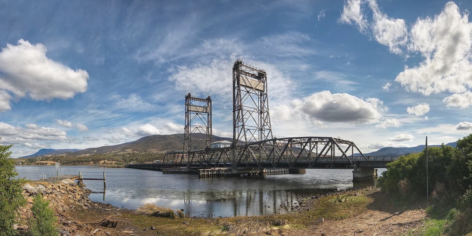
At kutalayna / Jordan River, the recognised Aboriginal name now stands beside the introduced name. The Bridgewater and Brighton reach is one of the clearest places to understand the river as a corridor rather than a view. Freshwater, tidal movement, roads, rail and successive bridges meet here.
How to research a Derwent place name
Start with Tasmania's official place-name register and LISTmap for the current spelling, status and location. For an Aboriginal or dual name, consult the Aboriginal and Dual Naming material from the Department of Natural Resources and Environment Tasmania. Historical charts in Libraries Tasmania, the National Library of Australia and the State Library of New South Wales can show when an introduced name entered print.
Treat neat origin stories cautiously. A repeated claim may trace back to one unsourced guidebook. Names can also carry several explanations, especially when a descriptive local name became official only later. A sound account separates what an official record confirms from what remains local tradition.
Seeing the river today
Useful public vantage points include Long Beach in Sandy Bay, the Hobart waterfront, Rosny Point, Bellerive, Otago Bay and the foreshore near the Bridgewater crossing. The Hobart rivulets page follows the smaller waterways that descend from kunanyi / Mount Wellington into the estuary. For the British naming voyage, read John Hayes and the charting of the Derwent.
The river is still changing. Restoration work, new transport infrastructure and formal dual naming continue to shape how people understand it. Its map should be read as a record under revision, not a finished list.