.jpg)
John Hayes spent only a short period in south-east Tasmania, yet several names from his 1793 survey remain on the map. River Derwent, Risdon Cove and Cornelian Bay connect modern Hobart to a voyage mounted from British India rather than Britain or New South Wales.
His journey is often compressed into a list of “discoveries”. That language hides two essential facts. Tasmanian Aboriginal people already knew and named these places, and a French expedition had charted the estuary shortly before Hayes arrived. His lasting influence came through British mapmaking and colonisation, not first human knowledge of the river.
From the Bombay Marine
Hayes was born in Cumberland in 1768 and joined the Bombay Marine, the East India Company's naval service, as a teenager. By 1793 he had years of experience in Indian Ocean service. He took command of a private commercial and exploratory venture using two vessels, the Duke of Clarence and the smaller Duchess.
The expedition left Calcutta in February. Its commercial ambitions extended beyond Van Diemen's Land, but weather and the need for supplies brought the ships to Adventure Bay in late April. From there Hayes examined the channel between Bruny Island and the mainland and entered the broad river to the north.
A survey after the French
Bruni d'Entrecasteaux's French expedition had carefully charted the same region early in 1793. Its surveyors called the estuary Rivière du Nord. Hayes did not have their chart and appears to have been unaware of how recently they had left.
This near overlap explains why French and British names sit beside each other across south-east Tasmania. D'Entrecasteaux Channel and Recherche Bay preserve the French voyage. Derwent, Risdon and other names preserve Hayes's chart or later British use.
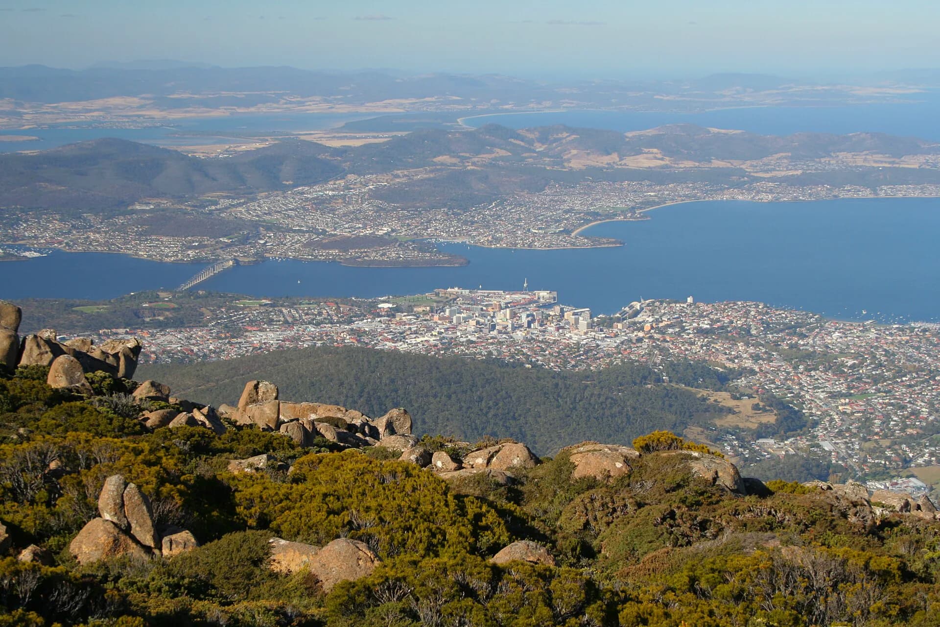

Hayes named the Derwent after the river in Cumberland near his family home. The introduced name endured because his sketch and names circulated among later British navigators. Flinders observed that succeeding visitors carried Hayes's chart while the French charts were initially less available to them.
What the chart shows
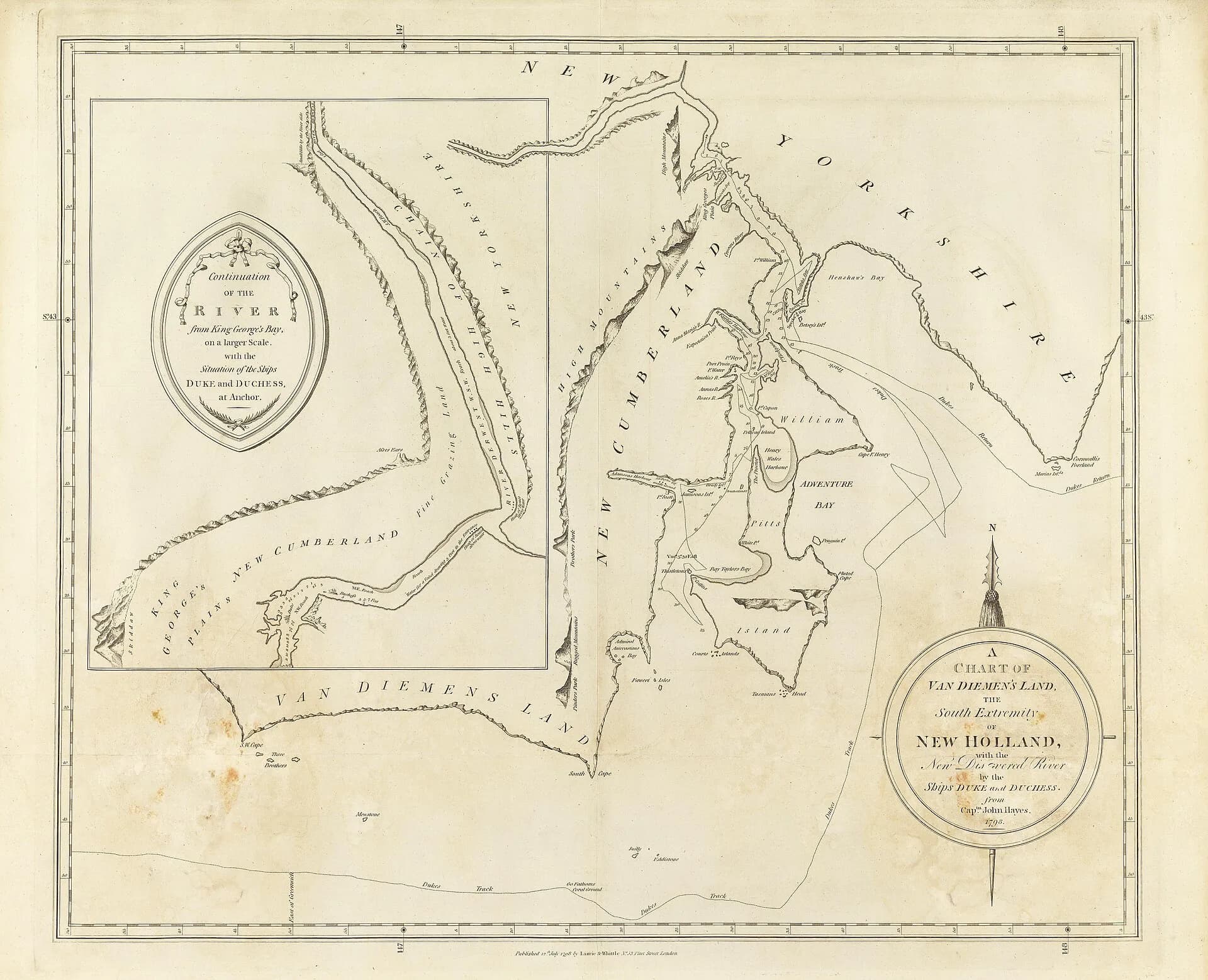
The published 1798 chart attributed to Hayes covers south-east Van Diemen's Land and identifies the “new discovered river” entered by the Duke and Duchess. It records soundings, shorelines, islands and English names useful to mariners. Like every chart of its period, it is also a claim about knowledge and possession.
Compare it with a modern map. Some names endured, some shifted and others disappeared. The outline is recognisable, but measurement and naming are uneven. The chart is best used as evidence of what British navigators recorded, not as a complete account of the region.
It contains no adequate representation of Aboriginal geography. The Muwinina, Mumirimina, Nuenonne and other communities had routes, resource areas and names that European nautical charts were not designed to preserve. Mapping therefore made some knowledge powerful while excluding other knowledge.
Places associated with Hayes
Risdon Cove was named for William Bellamy Risdon, an officer on the Duke of Clarence. Cornelian Basin, now Cornelian Bay, referred to stones noticed on the shore. Clarence Plains drew its English name from the expedition's larger ship. Hayes travelled well upriver, though later accounts differ on the precise reach attained by the vessels and boats.


The River Derwent names guide traces these labels alongside recognised Aboriginal names and later settlement. The point is not to memorise every eponym. It is to see how a brief maritime survey became embedded in everyday addresses.
Hayes after Tasmania
Hayes continued his career in the Bombay Marine. He served in campaigns in South and South-East Asia, rose to senior command and was made a Knight Bachelor for later military service. He died at the Cocos Islands on 3 July 1831 while returning towards Calcutta.
His intended account of the voyage was not widely published during his lifetime. A limited official response and the loss or dispersal of manuscripts left later historians reconstructing the expedition from charts, correspondence and surviving copies. That uncertain documentary history is another reason to distinguish firm evidence from repeated anecdote.
Reading exploration history carefully
Use “charted by” or “named by” when that is what the evidence supports. “Discovered” reproduces the viewpoint of an imperial map and ignores existing people and knowledge. Dates also need checking: older works sometimes place the voyage in 1794, while current biographical and Tasmanian reference sources date Hayes's Derwent visit to April 1793.
The surviving chart is available through the State Library of New South Wales, and the Australian Dictionary of Biography provides a concise account of Hayes's career. Together they are a better starting point than unsourced lists of place-name origins.