
Landscape and what to expect
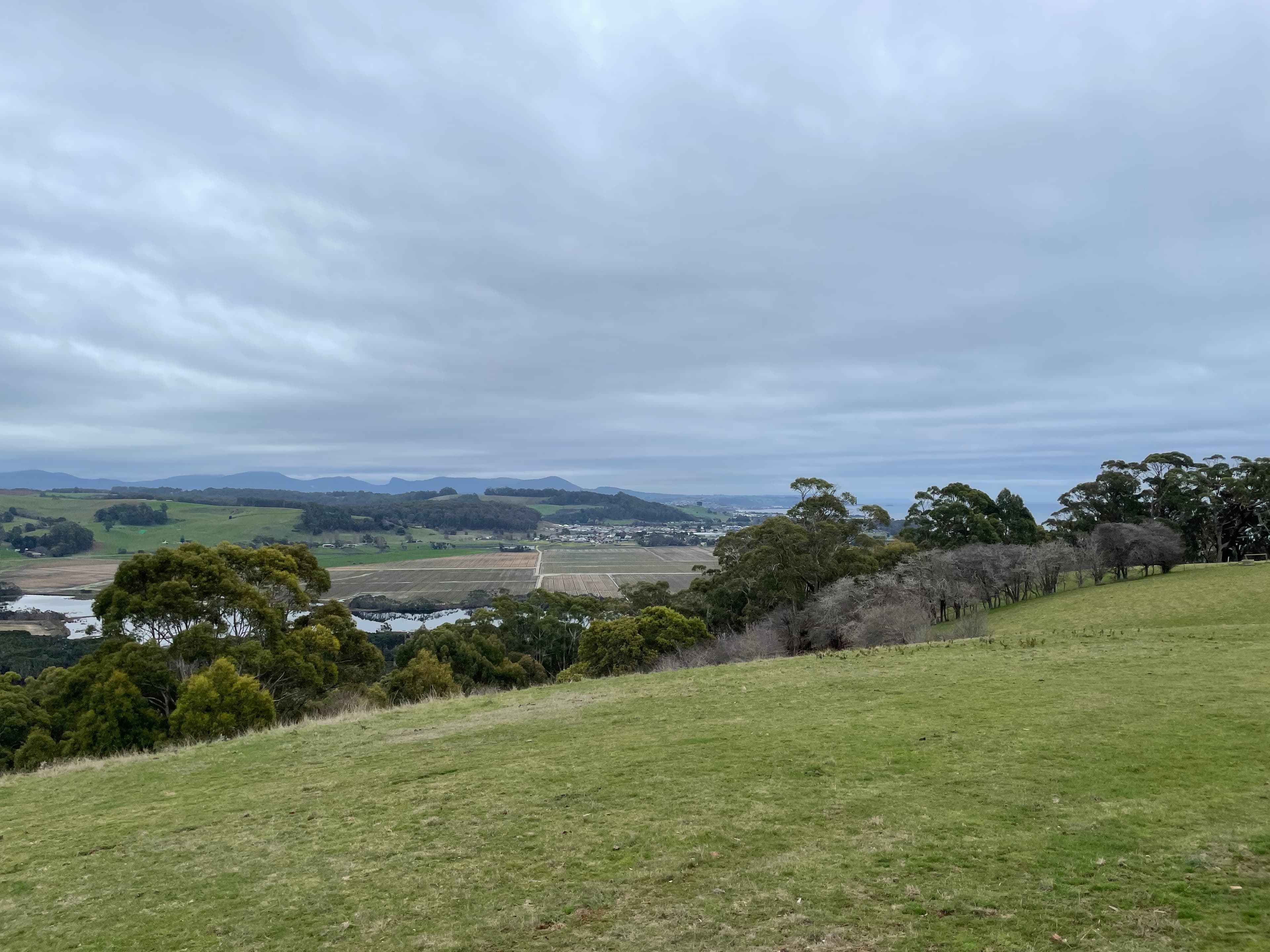
The Dial Range is a compact series of coastal hills with a variety of rock types and vegetation. You will move through dry eucalypt woodland and wet gullies with tall gum and tree ferns. Some slopes show the effects of past bushfire and you can find hollows used by birds and small mammals. The range offers coastal views towards Bass Strait from several summits.
The main peaks and typical walks
Mount Montgomery: a 5 km return Grade 3 walk usually taking about two hours. The route climbs around 330 m and follows Myrtle Creek through dry eucalypt forest to a 471 m summit with broad coastal views.
Mount Dial: several route options give a range of experiences. One popular route is about 8.2 km return, Grade 3 and typically takes 4–5 hours. A tougher option starts from Ferndene, climbs approximately 400 m over 3.8 km and is rated Grade 4 with minimal maintenance. A shorter approach via the Gnomon carpark is around 4.2 km return and may be done in roughly two hours.
Mount Gnomon Lookout: a short but steep 2 km return Grade 3 walk that rewards you with views over the southern Dial Range and out to Mount Roland on clear days.
Mount Duncan Track: a gradual 8 km return Grade 3 walk that explores tall eucalyptus forest and understorey; allow about four hours.
Ferndene State Reserve and the mining heritage
Ferndene features an elevated boardwalk along McBrides Creek that is described as an all‑access path, finishing at a viewing platform and seat among tree ferns. Near the picnic shelter you will find public toilets and a non‑potable water source at the trailhead.
From Ferndene you can visit Brownings and Thorsbys mining tunnels, open structures from historical prospecting and mining. These tunnels are unmaintained, may be muddy and slippery underfoot and have no lighting. They are listed as to be explored at your own risk.
Access, parking and facilities to check
Trailheads are accessed from unsealed and sealed roads west of Ulverstone and near Penguin. Parking at the main carparks is limited and turning space at Ferndene is restricted for large vehicles. Some carparks and reserve roads are shared with mountain bikers, so be mindful of other users when arriving or leaving.
Facilities are concentrated at Ferndene picnic area where there are toilets, a picnic shelter and shelter from the elements. Several tracks have no on‑track toilets; the closest public facilities to some trailheads are a short drive into Penguin. Water at Ferndene is non‑potable.
Campfires are not permitted within the reserves. Dogs, horses and motor bikes are not allowed on the walks.
Safety, suitability and checks before you go
Tracks are rated using a walk grading system. Grade 3 walks require some bushwalking experience and can include short steep sections, rough surfaces and many steps. Grade 4 routes are more demanding, can involve minimal maintenance, steeper climbs and rougher ground. Choose a walk that matches your fitness and skills.
Always check the weather forecast before you head out. Tasmanian conditions can change rapidly and cold can present a real hazard. Carry a map, record your trip intentions in any trail log book provided and let someone know your plans. If conditions are remote or uncertain, consider extra food, an emergency shelter and a Personal Locator Beacon (PLB). Plan to turn back if conditions or fitness levels deteriorate.
Avoid driving in the reserves at night where possible because local wildlife is active on roads. Mountain bikes use parts of the network; signs indicate whether a track is walking only, bike riding only or shared use, so check signage at the start.
Practical route choices and timing
If you have limited time and want a summit view, use the Mount Gnomon route for a short, steep outing. For a longer ridge experience that explores geology and orchids, choose the Mount Dial route from Mount Montgomery carpark and allow most of the day. The Ferndene start gives a gentler approach into the range and the chance to combine rainforest boardwalks with ridge walking, but expect the steeper final ascent and a route with lower maintenance.
Bring sturdy footwear for rough and occasionally muddy ground. If you plan to visit the mining tunnels bring a torch, sturdy footwear and take care on slippery surfaces, but note there is no formal lighting and exploring is at your own risk.
Navigation and maps
Buy a detailed topographic map if you plan to use the network of ridgelines and connectors. Signage marks key intersections, but some routes have limited maintenance and can be harder to follow. If you are unsure of your navigation skills, favour the better‑formed Grade 3 tracks or go with someone experienced.
Final considerations
Expect shared use with mountain bikes on several sections and limited parking at popular trailheads. Check facilities before you go, carry what you need, and respect park rules that protect the vegetation and heritage features of the Dial Range.