
Location and exposure
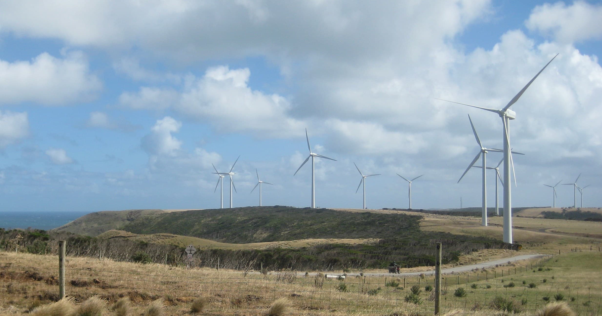
Kennaook / Cape Grim sits at the isolated north‑west tip of Tasmania, immediately south of Woolnorth Point. Scientific material describes the headland as remote and exposed to mid‑latitude Southern Ocean weather. The site occupies a latitude band near 40°S where air masses travelling over large stretches of ocean provide the clean conditions needed for baseline monitoring.
The monitoring station and measured quantities
The Kennaook / Cape Grim Baseline Air Pollution Station is a dedicated atmospheric observatory. It measures more than 80 greenhouse gases and trace species, including carbon dioxide, methane and nitrous oxide, plus synthetic gases such as hydrofluorocarbons and perfluorocarbons. The program also records aerosols such as sea salt, mineral dust and black carbon, reactive gases, and standard meteorological variables including wind, temperature, rainfall, humidity and solar radiation. The Australian Nuclear Science and Technology Organisation contributes measurements of the naturally occurring radioactive gas radon.
Baseline sector and air trajectories
For many research uses the station defines a baseline sector between 190 and 280 degrees. Air arriving from that sector has typically travelled many thousands of kilometres across the Southern Ocean and is regarded as free from recent human and terrestrial influences. That clean, well mixed air represents the background atmospheric composition for the mid‑latitude Southern Hemisphere. Observations outside the baseline sector carry signals from nearby land, cities, agriculture and other local sources, and should be treated differently when interpreting trends.
Why Cape Grim is important for climate science
The Southern Ocean has an outsize influence on the global climate system because it exchanges heat and gases between the atmosphere and the deep ocean. Scientists use Cape Grim’s long continuous measurements to track long‑term changes in atmospheric composition, to test climate models, and to study aerosol‑cloud interactions that affect how much sunlight reaches the ocean surface. Research has identified model biases in how aerosols and clouds are represented in the Southern Hemisphere, in part because cloud properties here differ from those in the Northern Hemisphere. Over the Southern Ocean the air is generally cleaner and biological aerosols, for example from phytoplankton, can influence the formation of super‑cooled liquid clouds, a process not currently well represented in many models.
History, archive and evolving methods
The rural monitoring program originated from a national commitment in the 1970s to measure global atmospheric composition. The station has been in continuous operation since the mid‑1970s; published material refers to measurements starting in April 1976 and elsewhere to a record spanning back to 1977. An air archive of preserved samples began in 1978 and enables retrospective analysis using modern methods. Measurement techniques have evolved over time. For example, carbon dioxide has been measured with cavity ring‑down spectroscopy since 2013, replacing earlier non‑dispersive infrared analysers, and some gases are measured after chemical conversion using gas chromatography with flame ionisation detection.
Recent research activity: CAPE-k
A collaborative field program named CAPE-k, short for Clouds And Precipitation Experiment at Kennaook, was reported to begin in April 2024. CAPE-k was planned to gather continuous observations over a full seasonal cycle of about 17 months, focused on aerosol and cloud processes. The program involves national agencies and international partners and aims to integrate its observations with the station’s long‑term record. Data from the CAPE-k project are intended to be published through participating research facilities for use in model development and climate projections.
Who runs the site and how data are used
The Kennaook / Cape Grim program is a joint responsibility of the Bureau of Meteorology and CSIRO. The Bureau funds and operates the baseline air pollution station, while CSIRO provides data quality assurance, analysis and interpretation. Station data are used to identify trace gas trends in the Southern Hemisphere, to improve climate model projections and weather forecasts, and to inform policy monitoring such as tracking progress towards international agreements. Project datasets are intended to be made publicly available by the relevant research repositories.
Visiting the headland: access and practical checks
The observatory is a working scientific facility on an exposed coastal headland rather than a tourist attraction. Published material emphasises the site’s remoteness and its need for clean air exposure. If you plan to approach the headland or nearby private property, check access arrangements and permissions first. Expect strong, changeable winds and rapidly shifting weather typical of the Southern Ocean and plan travel and safety accordingly. Confirm local access rules and recent operational status before travel.
Interpreting Cape Grim measurements
When using Cape Grim data, check whether the observations presented are baseline data or include other wind sectors. Baseline data are determined from hours when winds fall within the 190 to 280 degree sector. Monthly mean baseline concentrations are derived from smooth curve fits to the baseline hours measured in a month. Annual and decadal growth rates are calculated from those monthly and annual values. Users should note that many greenhouse gases measured at the site have shown continuous increases since the late 1970s, while some ozone‑depleting substances have declined following international controls.
Practical summary for visitors and data users
Treat Kennaook / Cape Grim as a sensitive science location set in exposed coastal terrain. For on‑site visits, confirm permissions and check up‑to‑date local weather forecasts. For research or curiosity about the atmosphere, institutional datasets and project repositories are the recommended source of validated measurements rather than informal reports or unauthorised site access.