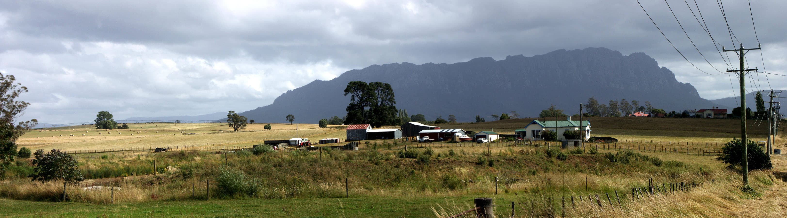

Why visit Mount Roland
Mount Roland rises to about 1 233–1 234 metres and forms a prominent backdrop to the Kentish district. The summit gives wide views north to Bass Strait and south towards Cradle Mountain, Barn Bluff and the Pelion Range on clear days. The reserve combines eucalypt woodland, buttongrass plains, heath and alpine boulder country, so the walk includes a sequence of distinct landscapes in one day walk.
Routes and difficulty
There are two main summit approaches. The Gowrie Park route off O'Neills Road is the most commonly used and is described as the easier of the two summit tracks. Parks Tasmania classifies the Mount Roland Track from Gowrie Park as Grade 3, about 16 km return with an expected 4 to 6 hours walking time. The climb gains almost 1 000 metres and the final section includes loose rock and a short boulder scramble to reach the trig point.
The Kings Road Face Track is steeper, shorter in time estimates in some local guides and is recommended only for experienced walkers. That route involves steep and awkward sections and some clambering over boulders, so it is not recommended for novice walkers.
Other walks in the reserve include Mount Vandyke and Mount Claude. Mount Vandyke is a more technical option with boulder scrambling, about 11 km return and classed as Grade 4. Mount Claude can be a shorter, steadily uphill option; one description lists it as about 5 km return and Grade 4. For a short forest stroll, the O'Neills Creek Nature Trail is roughly 1 km one way and Grade 3, taking about 20 minutes.
What you will see on the walk
From the lower slopes you walk through eucalypt woodland and along creeks and waterfalls on the Gowrie Park approach. Above the forest the track opens onto a plateau of buttongrass plains and heath. After about 15 minutes on the plateau there is a bench and table platform with expansive views for walkers who stop there. The final ascent climbs over loose rocks and a short boulder scramble to a rocky summit where a trig point marks the top and 360 degree views are the reward.
Getting there and trailhead practicalities
The preferred trailhead is near Gowrie Park. From Sheffield follow Claude Road (C136) south for about 15 kilometres to the Gowrie Park turn. Turn into O'Neills Road and follow for approximately 1 kilometre to the trailhead. Be aware that O'Neills Road is unsealed and can be rough. Parks Tasmania advises avoiding driving in reserves at night because of native wildlife on roads.
There are no facilities at the trailhead. Public toilets and picnic facilities are available at Gowrie Park village. Campfires, dogs and bikes are not permitted within the reserve. If you plan alternative routes, note that a circuit involving Mount Vandyke is possible but the Mount Vandyke track can be difficult to navigate and involves steep sections; it is recommended for experienced bushwalkers only.
Safety, gear and checks before you go
Weather in Tasmanian alpine country can change quickly and include rain, wind, sun and snow at any time of year. Before you leave, check the local weather forecast and pick a walk that matches your fitness and experience. Carry a waterproof jacket with a hood, waterproof overtrousers, warm layers such as a fleece and thermal base layers, and sturdy walking boots. The Parks Tasmania guidance notes that deaths have occurred when people were unprepared in cold, wet and windy weather. Children, older people and those with illness or disability are at greater risk in poor conditions.
Plan to walk safely. Avoid walking alone where possible and tell someone your plans. Record your trip intentions in the log book where one is provided or otherwise leave details with a contact. Carry a map, and if you are walking in remote or uncertain conditions consider extra food, a Personal Locator Beacon and an emergency shelter or tent. Observe all track signs and stay on formed walking tracks to protect both your safety and sensitive alpine vegetation.
Restrictions and park status
Mount Roland sits inside Mount Roland Regional Reserve. Parks Tasmania manages the tracks and enforces rules aimed at conserving natural and cultural values. Aside from the no campfire, no dogs and no bikes rules, visitors should follow site signs. Driving at night in the reserve should be avoided because native wildlife are active on roads.
Brief practical checklist
- Track: Mount Roland Track (Gowrie Park) Grade 3, about 16 km return, 4–6 hours.
- Alternative: Face Track from Kings Road is steeper and suited to experienced walkers.
- Mount Vandyke: Grade 4, about 11 km return, more technical.
- Facilities: no trailhead facilities; toilets and picnic area at Gowrie Park.
- Road: O'Neills Road is unsealed.
- Must carry: waterproofs, warm clothing, sturdy boots, map.
- Consider: Personal Locator Beacon and emergency shelter for remote or uncertain conditions.
- Restrictions: no campfires, dogs or bikes in the reserve.
Follow the published track grades and the safety guidance from park authorities when planning a visit.