
Lenah Valley

Situated in the foothills of Mount Wellington, the picturesque Hobart suburb of Lenah Valley lies north of the CBD between Mount Stuart, New Town and the City of Glenorchy. As Lenah Valley nudges into the foothills of the mountain, there are great walking tracks close by that will take you into Wellington Park and all the way up to the peak if you are so inclined. John Turnbull Park is the main recreational area, holding sports events like Little Athletics and AFL; this park is also very dog friendly.
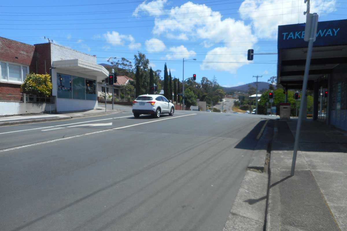
The air smells clean and fresh, the unspoilt New Town Rivulet flows down the mountainside and through middle of the suburb at the Lenah Valley Road end, making it hard to believe Hobart city is so close by. The main arterial thoroughfares are Augusta Road, Creek Road, Lenah Valley Road and Girrabong Road. A small retail shopping strip is found on Augusta Road. North Hobart is no more than a 5 minute drive away, with what is probably Hobart's biggest restaurant scene.

New Town Rivulet
The New Town Rivulet (also known as Newtown Creek) is a permanently flowing creek that has as its headwaters the springs and snow water run-offs of Mount Wellington. The New Town Rivulet flows from its headwaters though Lenah Valley and New Town to New Town Bay in the River Derwent. The rivulet is fed by a number of underground springs in the Wellington Range. New Town Rivulet starts around Big Bend Carpark at an elevation of 982m and ends flowing into the River Derwent. The Rivulet drops around 982m over its 10.9km length.
The upper reaches of New Town Rivulet are easy to access via walking and cycling tracks alongside the Rivulet and Lenah Valley Road. The Rivulet can also be accessed via the Intercity Cycleway at Creek Road and then up it to Lenah Valley Road, following the New Town Rivulet. The track paralells the road for most of the way beside the Rivulet.
About Newtown Rivulet
The New Town Rivulet Track is a very rewarding walking trail. Following New Town Rivulet upstream from its junction with the Derwent River is a wonderful journey of discovery. The landscape changes steadily from urban to suburban to bushland. There is history too, with glimpses of colonial houses with their rambling gardens, a convict-built bridge beneath New Town Road plus the unexpected Greek-style temple of Lady Franklin Museum. The sound of running water is ever present and in the higher reaches there are lovely pools and cascades. Small trout and native fish are often seen darting past and if you are very lucky you may even spot a platypus.
Track notes and map

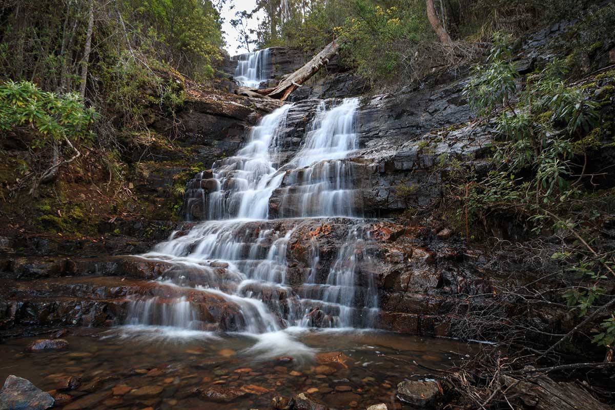
The two and a half hour return trip from the start of the Lenah Valley Track to New Town Falls takes you from sea level to 430m in elevation to meet this lovely waterfall. It is highly recommended to be prepared for this walk by taking plenty of water and some food with you. Once you do arrive you will be greeted by multiple tiers of cascades and a beautiful view out across Lenah Valley towards the Derwent River. There are multiple sections to New Town Falls with the main path leading to the middle tier. You can ascend higher to see the top or descend to the very lower-tier via a track approximately five minutes back from the main section of the fall. It flows best after heavy rain and is part of the New Town Rivulet.
Brief History
Lenah Valley was settled in 1817 when the first land grant was issued for agricultural purposes. The area was known by various names including Kangaroo Bottom, Kangaroo Valley, and Sassafras Valley. It was renamed Lenah Valley in 1922, as the newly established tram service to the area needed a shortened name to fit on the route signs on the tram cars. The aboriginal term for kangaroo ‘Lenah’ was chosen as the suburb’s official name as it retains a link to its former name. Augusta, the name of the village at the end of Augusta Road in area known as Kangaroo Flats, was simply retained as the name of the main road leading up to the Museum.
Cnr Pottery Road and Augusta Road, end of the line for the Lenah Valley tram service
The eastern end of Lenah Valley was first settled near the older area of Mount Stuart. James Sherwin established one of Australia's earliest commercial potteries in 1831 along Pottery Road, Lenah Valley. The Newlands manor house was built in the late 1830s and had surrounding agricultural interest such as orchards. The manor house influenced development of the surrounding area and ensured that quality homes were built in the surrounding area in order to maintain the reputation of the area. It is currently used as a venue for events such as wedding receptions. Newlands House is now officially in the suburb of Mount Stuart.
In 1845 the valley was promoted as an ideal place for grazing dairy herds on account of the areas rich pastures. Dairying was the most important industry next to fruit growing and during the early twentieth century up to twenty herds of dairy cattle were kept in the district.
Forming part of the original boundary of the early European settlement grants issued under the name of ‘McLacklan’, Montagu Street runs north and south of Augusta Road. The area was part of the original European settlement of the Lenah Valley area and a number of substantial properties were built in the area, including ‘Jutland”, the home of Colonial Architect John Lee Archer in 1831. By the end of the nineteenth century a number of these settlement grants had been consolidated to form part of an estate owned by local merchant James Macfarlane. This was subsequently acquired by Co-Operative Estates and subdivided for residential development in 1913-14, the first house being erected soon after.
The area around Doyle Avenue remained primarily agricultural land until the turn of the 20th century. The Doyle Avenue area formerly known as Gilbert Avenue was subdivided by Co-Operative Estates in 1913-14 although uptake of these residential blocks were slow and little building occurred until the 1920s.
Development prior to the WW2 was primarily made up of generous garden allotments with Federation and Inter-War styled houses, there were also pockets of earlier farm land and orchards on the hills of the valley. This period saw the majority of Australians living comfortably with an abundance of materials and produce. The post-war era however experienced a heightened degree of economic, and subsequently architectural, restraint.The post-war period saw a boom in the development of the more affordable outer suburbs with the development of new industries, private vehicle ownership, public transport routesand the Australian dream of owning a home on a quarter-acre block. These post war subdivisions in Lenah Valley are characterised by modest / medium houses, which was often produced in mass. These developments became an immediate priority for a rapidly growing population. Post war architecture saw the emergence of Internationalist, Late Art Deco, Streamline Moderne and Austerity designs, many of which are present in the Valley.
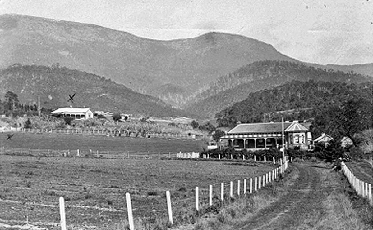
"Augusta Road, Lenah Valley, showing the property 'Roseways' in foreground and a distant view of 'Malvern,' owned by W.C Cato". Source: Archives Office of Tasmania. This photograph shows the original location of Roseways and the Victorian house rebuilt on the site.
Augusta Road has been a main arterial road to the city of Hobart since the earliest days of European settlement. Back then, the district surrounding Augusta Road was initially settled by bushmen and sawyers who supplied Hobart Town with large quantities of building timber. The district was known initially as Kangaroo Flat, and then the Augusta Road District. One suspects it was named after Princess Augusta Sophia, the daughter of King George III.
In the year 1877, The Tasmanian Gazeteer recorded: "AUGUSTA (Co. Buckingham) is a postal village and residential suburb of Hobart Town, in the police district of Hobart, and electoral district of Glenorchy. It is situate on the main road from Hobart Town to Launceston, about 2 miles from the former place, and on the New Town Rivulet, which empties itself in to the Derwent, near Risdon. A portion of Mount Wellington overlooks the district. There are no mills or manufactories in Augusta at present, except a pottery. The surrounding district is agricultural to a large extent. There are several coal seams in the district; two or three are being worked, and produce very good domestic fuel. The communication with Hobart Town is by ‘busses and other conveyances which run hourly. The city of Hobart Town adjoins Augusta N.W. There is one hotel in the village, the Harvest Home. The surrounding country is undulating and hilly. The population numbers about 300 persons. There are places of worship as follows: Church of England, Church of Rome, and Wesleyan Church."
The Kangaroo Valley Inn once stood at 88-90 Augusta Road. The Inn was known to be the drinking place of New Town coal miners, but with the closure of the coal mining enterprises in the 1870s and 80s, the inn lost its clientele and closed down. The building was then used as a residence until the 1920s when it was demolished, no sign of its existence has survived.

Site of Roseway
Subsequent intensification of residential development along the road did not occur until the early twentieth century as estates began to be subdivided to meet the pressure of Hobart’s increasing population. Development occurred sequentially along Augusta Road with proximity to transportation routes considered a premium, with housing becoming more modest as distance increased from Main Road. The pace of subdivision accelerated with the introduction of tram services along Augusta Road in 1922, which terminated at Pottery Road. Augusta Road went as far as Roseways, a short distance beyond the terminus. Roseways was a property owned by Governor Davey since 1815, where he built a residence for his daughter who married Dr James Scott, Colonial Surgeon. Roseways was beside the Rivulet on the site of milk processing plant.
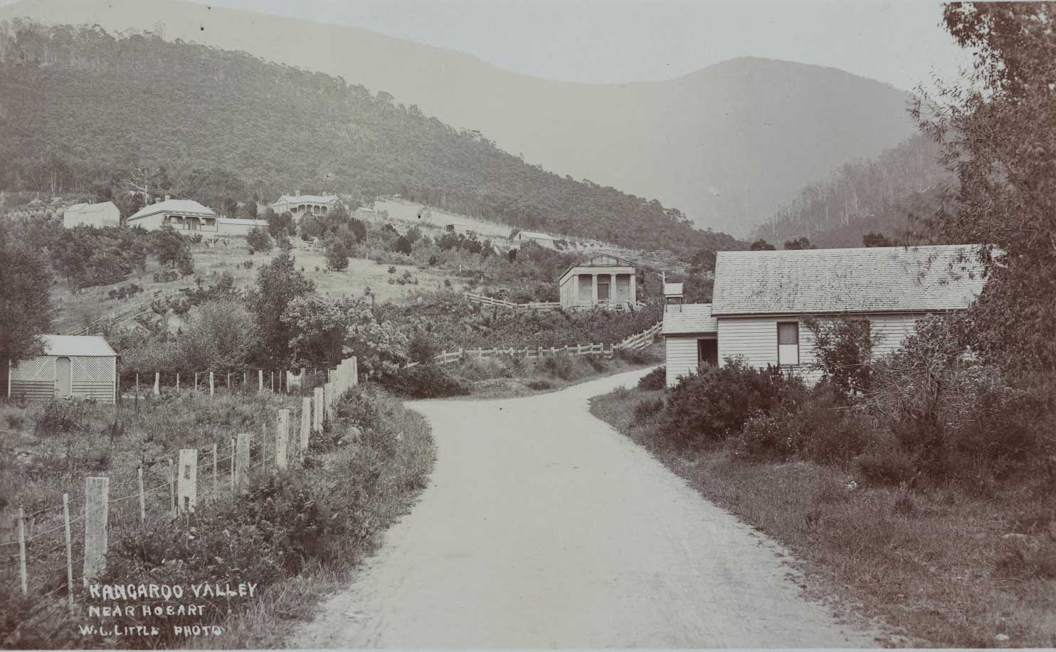
The Back Road, now Lena Valley Road, showing Lady Franklin's Ancanthe. C1920
The Back Road, now Lenah Valley Road, was once the main thoroughfare through the valley since the days of early settlememt. Travellers on foot and horseback utilised this road which ran alongside the New Town Rivulet and over the foot hills of Mount Wellington, all the way to South Hobart.
Soon after their arrival in Tasmania, Sir John Franklin, the tenth Lieutenant Governor, and his wife, Lady Jane Franklin, began visiting Roseway frequently. She was so taken by the natural beauty of the area, she purchased some 400 to 500 acres above Roseway beside the New Town Rivulet and the Back Road. Lady Jane named her property Ancanthe - a Greek word meaning 'vale of flowers' - and built a small cottage close to where the Anglican Church now stands. She had a number of bridle tracks cut, as she was very fond of riding through the bush property, and decided to create a native arboretum there, which it almost was by nature.
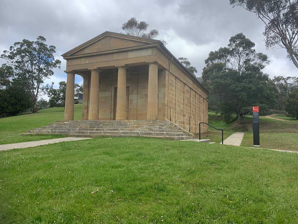
Out of her private purse, Lady Jane built the solidly constructed stone building using convict labour, which still retains the name of Lady Franklin’s Museum. She was a strong believer in education and brought plans from England for her museum, to be built in the Greek revivalist style that was popular at the time. She had a strong desire to see the cultural tone of Hobart lifted, and saw Lenah Valley as the perfect setting for what she intended to become Hobart's cultural and educational centre. Not long after Lady Franklin's "Tasmania Museum" was opened in 1843, Sir John was recalled as lieutenant-governor, and they left Ancanthe and the museum to Queens College.
Over the years, much of the land was sold off, the collections in the museum disappeared and the building left to ruin. The City of Hobart Council took ownership of Ancanthe Park and the museum in 1921, slowly restoring the temple-like building over the years. It is now occupied by the Art Society of Tasmania (AST), which took over the building in 1948. The Society holds monthly art exhibitions, workshops, tours and social events — close to Lady Franklin's vision for the space.